Vancouver Island
Apr. 20th, 2024 11:02 amGetting to God's Pocket is something of an expedition, involving a 500 mile drive, a ferry to Vancouver Island, and an hour long boat trip from Port Hardy to Hurst Island. Some people did that in a single day. I thought they were insane, and stayed overnight each way in Nanaimo near the ferry dock, so I could have a leisurely drive up Vancouver Island and enjoy the scenery.
Horseshoe Bay, where the ferry to Nanaimo leaves the Canadian mainland. It was a lovely day for the start of my trip.

Views from the ferry.


After the overnight in Nanaimo, it was a considerably greyer morning for the drive north. This was Qualicum Beach.

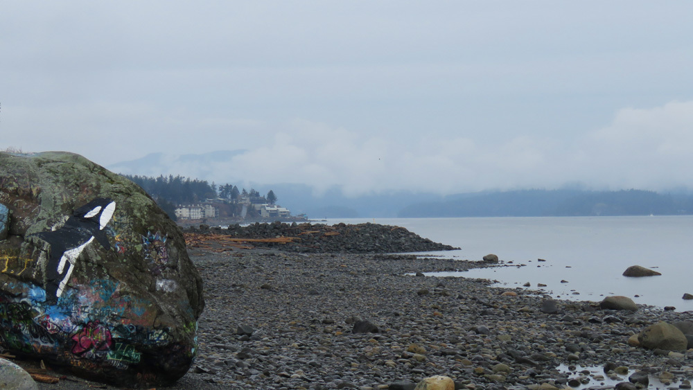
And Fanny Bay. (You have to take a photo of a place called Fanny Bay, right? Definitely more of a fishing village than anything else.)

Campbell River. It's on the 50th meridian (that's important enough that they have a large marker saying so).

Meandering north for two hours along the coast road between Nanaimo and Campbell River was perfectly pleasant and pretty much like civilisation. The towns were small but frequent, and there was a phone signal the whole way. Then the second you set out north of Campbell River, bam! You're in nowhere land. No cell service, one highway and pretty much nothing but trees and when the trees part, views of mountain peaks. I forget sometimes how utterly lovely it is to just drive - an empty road, no traffic, do what you want. I'd say it must be a lovely drive in summer, except then it's probably full of RVs...

The Sayward Valley with mist over the hills.

I didn't have too much time for sight-seeing on the northbound trip, since I had to be in Port Hardy at 3pm to meet the boat. Going back south, I was free of time limits except nightfall, so I had more scope for side trips and short hikes.
I did a three mile walk to Elk Falls and Deer Falls near Campbell River. This is the first view of Elk Falls from an overlook.

Skunk cabbage on the approach to the falls.

A suspension bridge crosses the river above Elk Falls.

Which then gives you this view right down into the river gorge.

Campbell River above the falls.

And the rather less spectacular Deer Falls. Probably nicer when there isn't construction work for a dam on the hillside above it. The pool below it is also a popular swimming spot in summer, not so much on a drizzly day in March.

Just north of Campbell River, a clearcut by the highway allowed views over Seymour Narrows - a major shipping channel between Vancouver Island and Quadra Island which apparently has vicious currents.

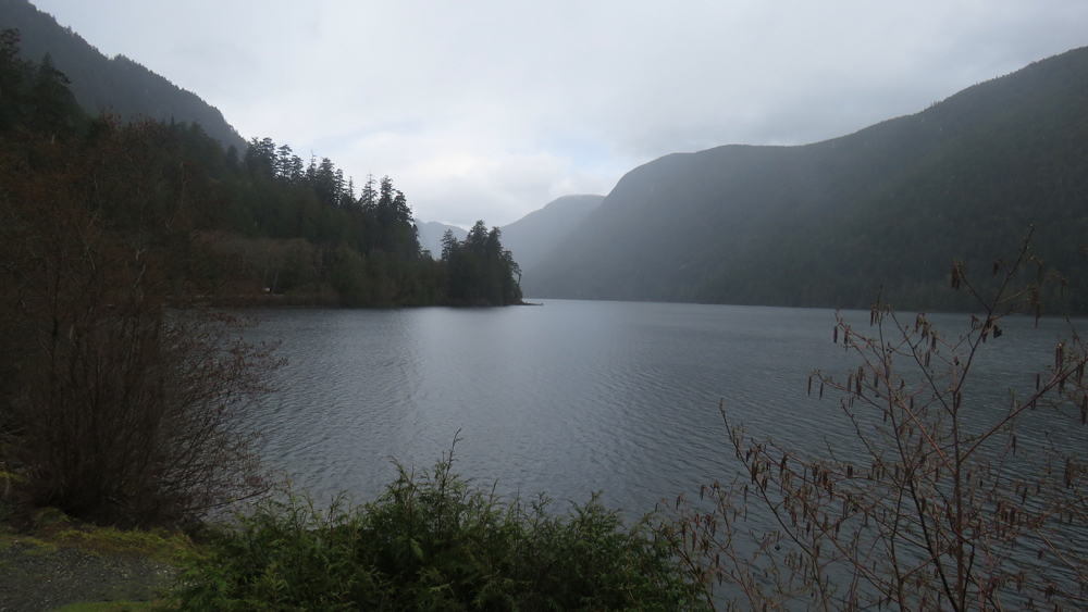
Cameron Lake on the road to Port Alberni.
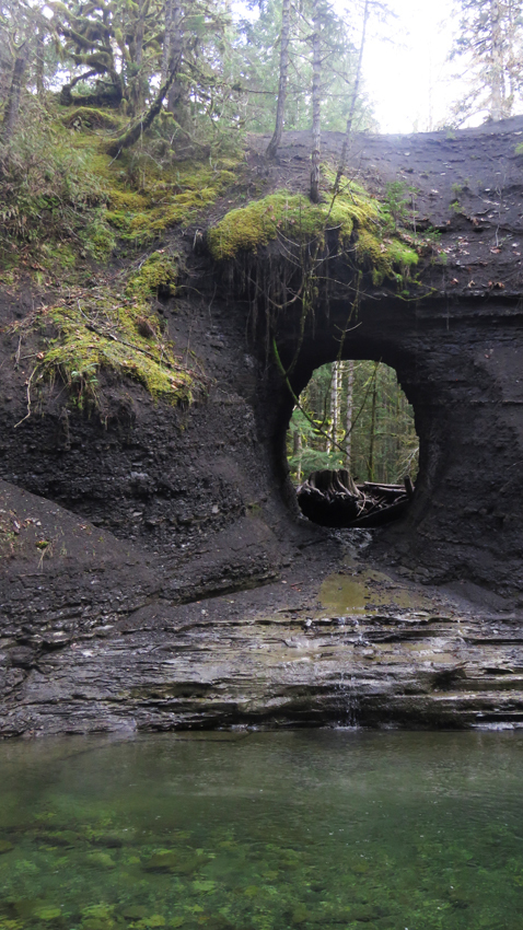
Near Port Alberni, I did another short hike to a place called Hole in the Wall. Here a large pipeline was once drilled through a cliff. The pipeline is long gone, leaving only the namesake hole.
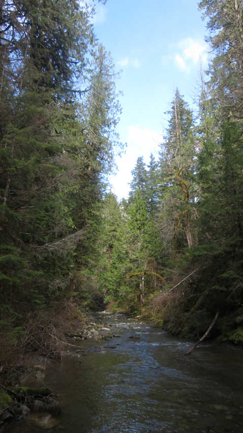
Looking upstream from Hole in the Wall. It almost looks like the sun was going to come out! This was deceiving...
A rotting stump with a large hole in it and the shale cliff beyond.

Wet mossy forests can be beautiful.

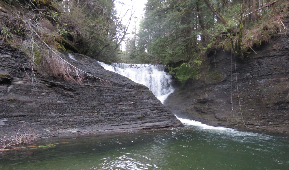
Downstream from Hole in the Wall is another waterfall (and another popular swimming spot, judging by the rope hanging down on the other side of the river).
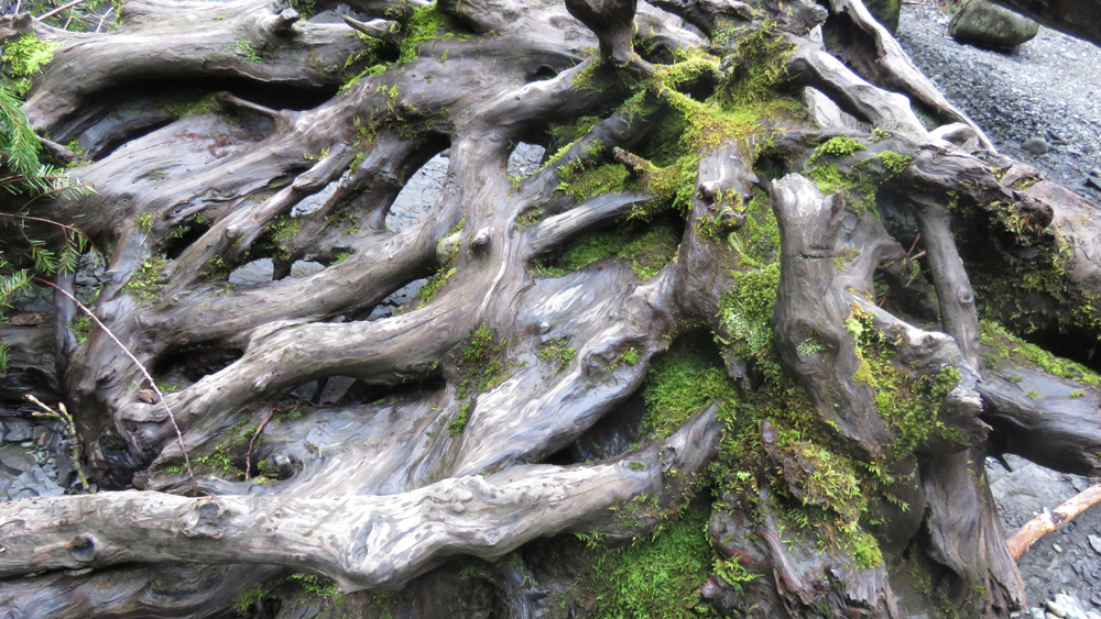
Mossy roots of an old tree stump as abstract art.
Leaving Nanaimo the next morning in similarly damp circumstances.

Views from the ferry back to the mainland, in different conditions than the outbound ones.


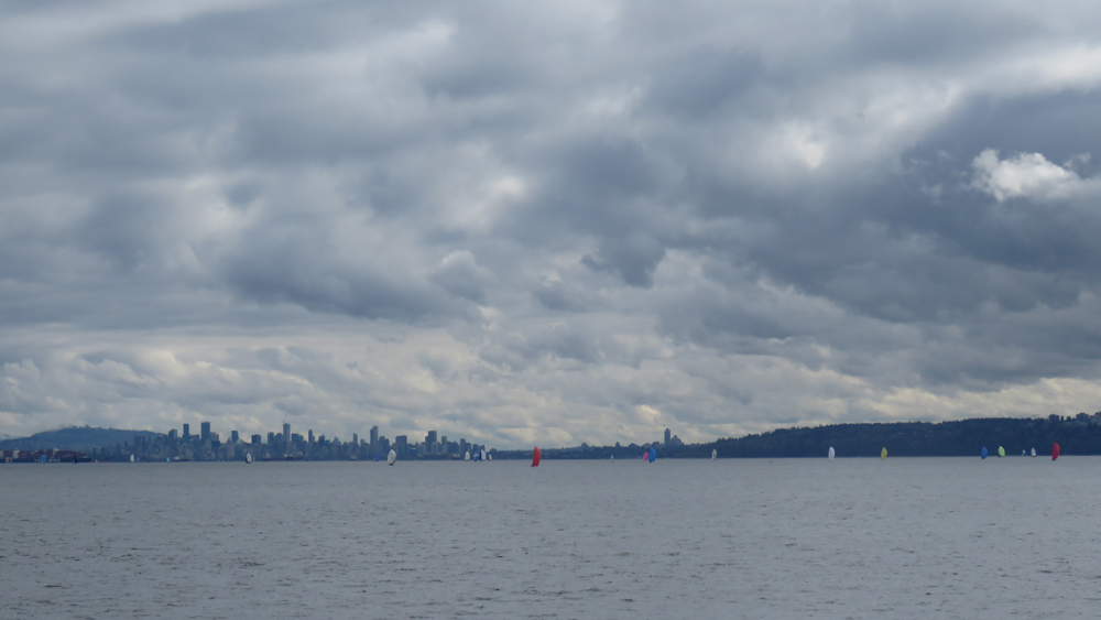
A sailing regatta near Vancouver.
The final approach to Horseshoe Bay.

I'd never been north of Nanaimo before, only south to Victoria, so it was good to see a bit more of Vancouver Island. I'm really glad I chose to do the drive the slow and leisurely way!
Horseshoe Bay, where the ferry to Nanaimo leaves the Canadian mainland. It was a lovely day for the start of my trip.
Views from the ferry.
After the overnight in Nanaimo, it was a considerably greyer morning for the drive north. This was Qualicum Beach.
And Fanny Bay. (You have to take a photo of a place called Fanny Bay, right? Definitely more of a fishing village than anything else.)
Campbell River. It's on the 50th meridian (that's important enough that they have a large marker saying so).
Meandering north for two hours along the coast road between Nanaimo and Campbell River was perfectly pleasant and pretty much like civilisation. The towns were small but frequent, and there was a phone signal the whole way. Then the second you set out north of Campbell River, bam! You're in nowhere land. No cell service, one highway and pretty much nothing but trees and when the trees part, views of mountain peaks. I forget sometimes how utterly lovely it is to just drive - an empty road, no traffic, do what you want. I'd say it must be a lovely drive in summer, except then it's probably full of RVs...
The Sayward Valley with mist over the hills.
I didn't have too much time for sight-seeing on the northbound trip, since I had to be in Port Hardy at 3pm to meet the boat. Going back south, I was free of time limits except nightfall, so I had more scope for side trips and short hikes.
I did a three mile walk to Elk Falls and Deer Falls near Campbell River. This is the first view of Elk Falls from an overlook.
Skunk cabbage on the approach to the falls.
A suspension bridge crosses the river above Elk Falls.
Which then gives you this view right down into the river gorge.
Campbell River above the falls.
And the rather less spectacular Deer Falls. Probably nicer when there isn't construction work for a dam on the hillside above it. The pool below it is also a popular swimming spot in summer, not so much on a drizzly day in March.
Just north of Campbell River, a clearcut by the highway allowed views over Seymour Narrows - a major shipping channel between Vancouver Island and Quadra Island which apparently has vicious currents.
Cameron Lake on the road to Port Alberni.
Near Port Alberni, I did another short hike to a place called Hole in the Wall. Here a large pipeline was once drilled through a cliff. The pipeline is long gone, leaving only the namesake hole.
Looking upstream from Hole in the Wall. It almost looks like the sun was going to come out! This was deceiving...
A rotting stump with a large hole in it and the shale cliff beyond.
Wet mossy forests can be beautiful.
Downstream from Hole in the Wall is another waterfall (and another popular swimming spot, judging by the rope hanging down on the other side of the river).
Mossy roots of an old tree stump as abstract art.
Leaving Nanaimo the next morning in similarly damp circumstances.
Views from the ferry back to the mainland, in different conditions than the outbound ones.
A sailing regatta near Vancouver.
The final approach to Horseshoe Bay.
I'd never been north of Nanaimo before, only south to Victoria, so it was good to see a bit more of Vancouver Island. I'm really glad I chose to do the drive the slow and leisurely way!
no subject
Date: 2024-04-20 11:13 pm (UTC)no subject
Date: 2024-04-21 12:45 am (UTC)no subject
Date: 2024-04-21 05:01 am (UTC)That last picture makes it look like the clouds are falling...and that it's so quiet and peaceful out there.
Today was rather cloudy with some sprinkles thrown in during the day. I rather like cloudy, cold days rather than sweltering hot. Your drive home was good?
no subject
Date: 2024-04-21 05:45 am (UTC)Clouds over mountains are the most amazing thing. They can look fantastic.
You know me, I like the heat. I can appreciate the aesthetics of clouds and moss, but I'm never going to argue against blue skies and blue ocean!
no subject
Date: 2024-04-21 07:24 am (UTC)no subject
Date: 2024-04-21 01:53 pm (UTC)no subject
Date: 2024-04-22 04:02 am (UTC)no subject
Date: 2024-04-22 04:12 am (UTC)