Burroughs Mountain Loop
Sep. 17th, 2023 10:26 pmAnother perfect Friday, and I took off for Mount Rainier (Tahoma) National Park, and the Burroughs Loop out of Sunrise, which I haven't done in quite a few years (definitely pre-covid) but blows my mind every time.
I do the loop anti-clockwise, and start with the short climb up to Sourdough Ridge. Looking north from the ridge, the Cascade peaks extend to infinity.

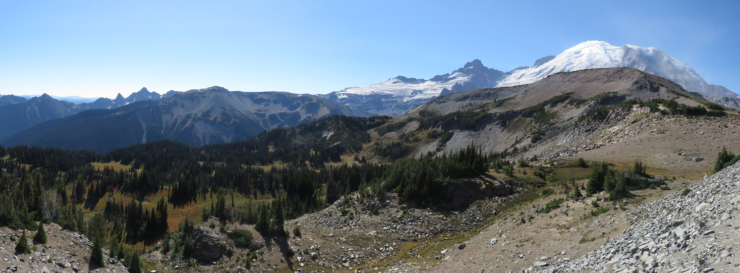
Looking south, I can see most of the hike - on the right is Burroughs, with Tahoma/Rainier behind it, and on the left is the valley around Shadow Lake that I hike through on the way back.
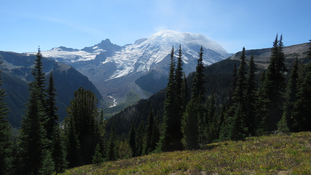
Another view of Tahoma from early in the hike, across a meadow.
After a mile or so along Sourdough Ridge, the trail reaches Frozen Lake. Misnamed in some ways (it's really not much more than a pond), it definitely spends a lot of the year frozen...

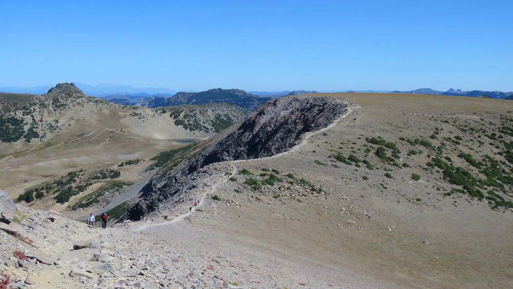
Past Frozen Lake, you start the climb up Burroughs - here, the shoulder of it obscures most of the Tahoma view.

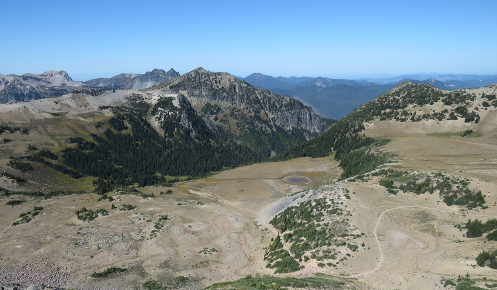
As you ascend Burroughs, the view of Berkeley Park valley opens up below. That valley is a great place for wildflowers in late July.
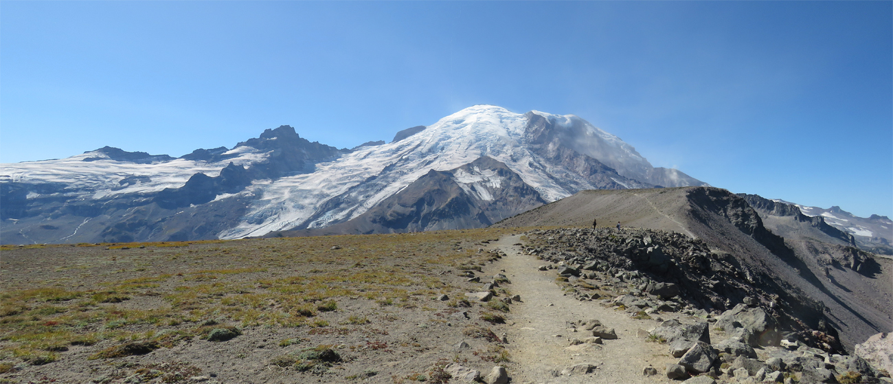
Then as you reach the flat top of First Burroughs, Tahoma comes back into view. Second Burroughs, on the right, is where I'm going next.
Being on top of Burroughs is as close as most of us will ever get to being on Mars. The same volcanic rock and soil, orange-tinged dirt and scattered rocks. The difference is you can breathe, and there are tiny alpine plants scattered between the stones.
The view back to First Burroughs from the trail up to Second.
The full expanse of Tahoma from Burroughs, with Emmons glacier extending down on the left.

Cascade golden-mantled ground squirrel on top of Second Burroughs.

View from Second Burroughs, looking at Tahoma and Glacier Basin below it.

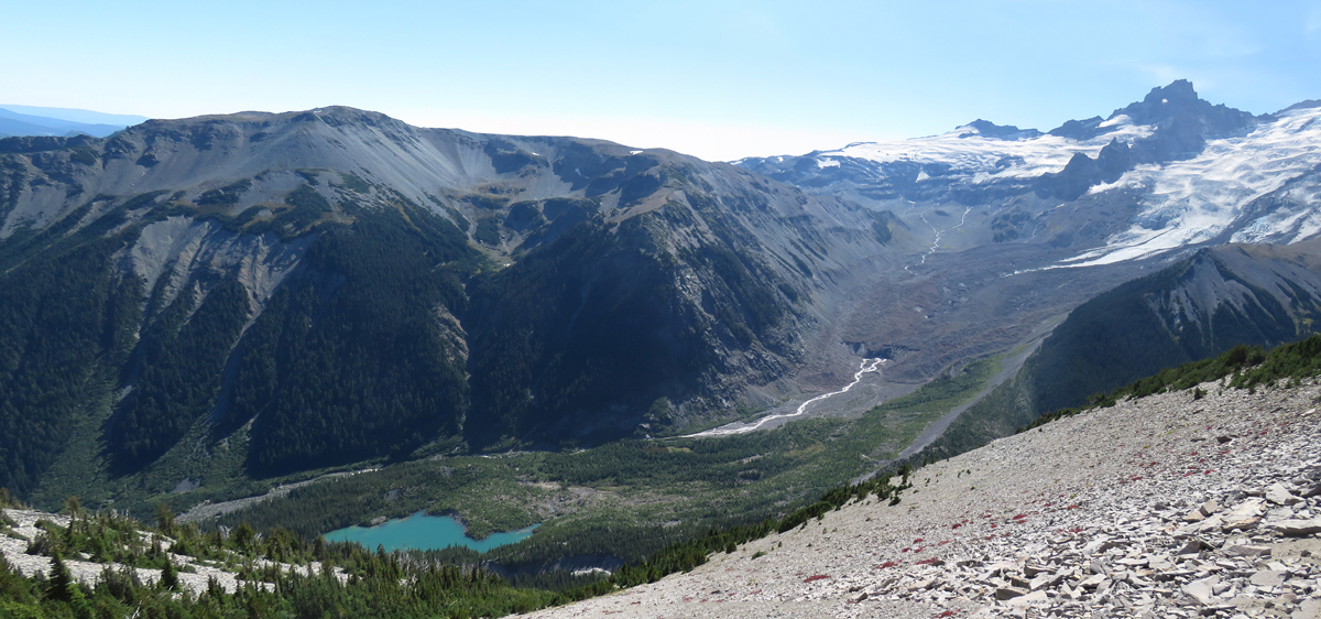
Emmons glacier, the source of the White River, and the stunning lake below it. The glacier must have looked amazing when it was all white, but a rockslide from Little Tahoma covered the bottom half of it in the 1960s. You can see where the White River emerges from its end.
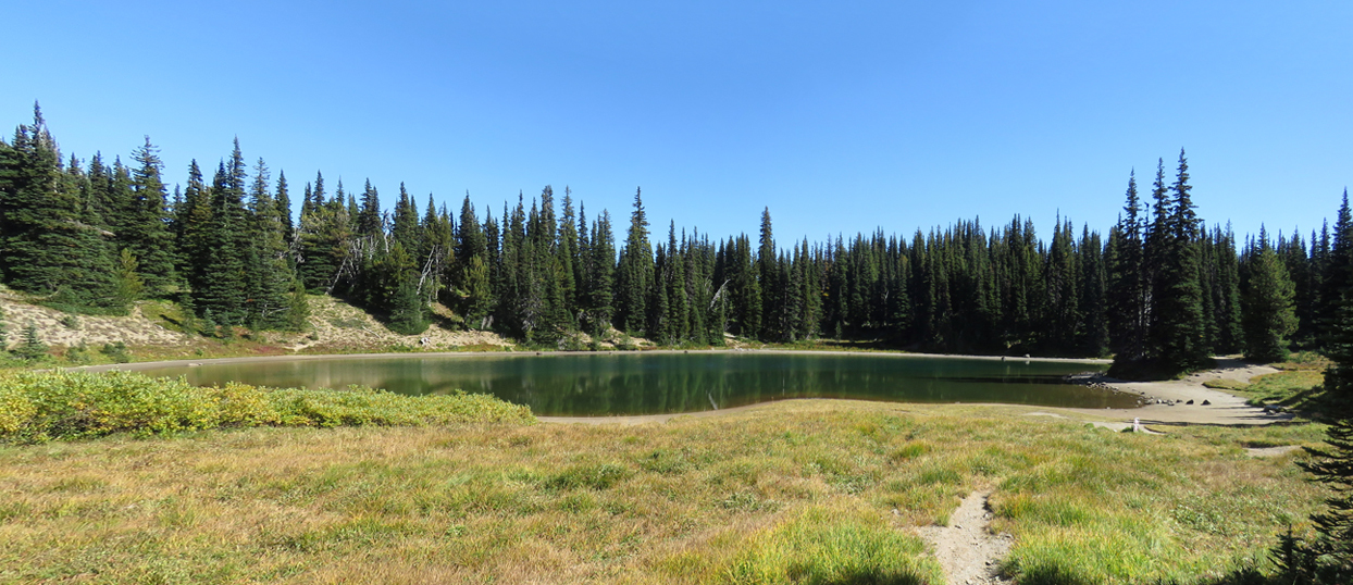
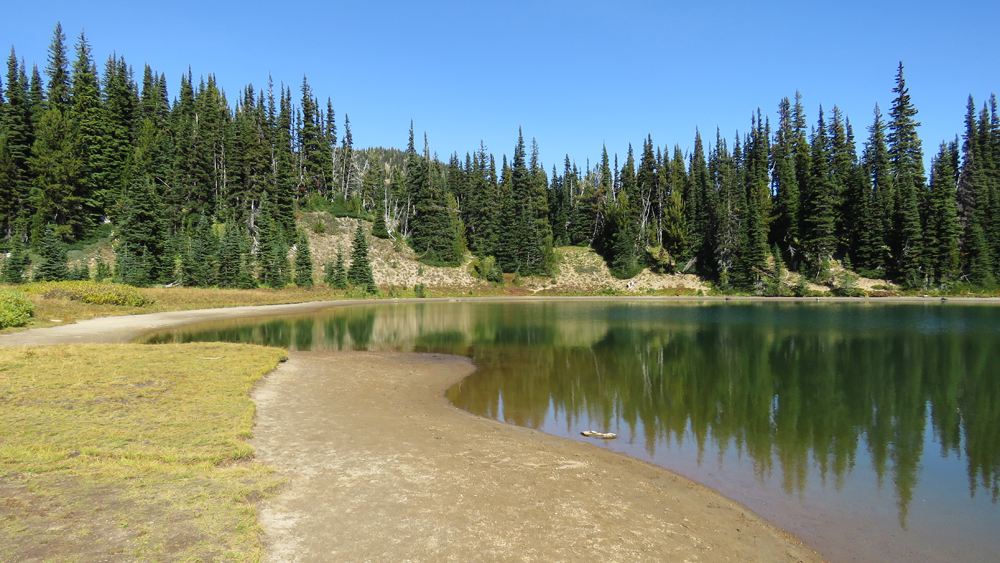
Back down at the bottom of Burroughs, you enter the valley near Shadow Lake. Which honestly isn't much more than a pond either.
Looking across a meadow to Sourdough Ridge, which I traversed at the start of the hike.

And then it's another mile back to the car park. 6.7 mile loop, 1200 feet of climb, maximum height 7400 feet on Second Burroughs.
I do the loop anti-clockwise, and start with the short climb up to Sourdough Ridge. Looking north from the ridge, the Cascade peaks extend to infinity.
Looking south, I can see most of the hike - on the right is Burroughs, with Tahoma/Rainier behind it, and on the left is the valley around Shadow Lake that I hike through on the way back.
Another view of Tahoma from early in the hike, across a meadow.
After a mile or so along Sourdough Ridge, the trail reaches Frozen Lake. Misnamed in some ways (it's really not much more than a pond), it definitely spends a lot of the year frozen...
Past Frozen Lake, you start the climb up Burroughs - here, the shoulder of it obscures most of the Tahoma view.
As you ascend Burroughs, the view of Berkeley Park valley opens up below. That valley is a great place for wildflowers in late July.
Then as you reach the flat top of First Burroughs, Tahoma comes back into view. Second Burroughs, on the right, is where I'm going next.
Being on top of Burroughs is as close as most of us will ever get to being on Mars. The same volcanic rock and soil, orange-tinged dirt and scattered rocks. The difference is you can breathe, and there are tiny alpine plants scattered between the stones.
The view back to First Burroughs from the trail up to Second.
The full expanse of Tahoma from Burroughs, with Emmons glacier extending down on the left.
Cascade golden-mantled ground squirrel on top of Second Burroughs.
View from Second Burroughs, looking at Tahoma and Glacier Basin below it.
Emmons glacier, the source of the White River, and the stunning lake below it. The glacier must have looked amazing when it was all white, but a rockslide from Little Tahoma covered the bottom half of it in the 1960s. You can see where the White River emerges from its end.
Back down at the bottom of Burroughs, you enter the valley near Shadow Lake. Which honestly isn't much more than a pond either.
Looking across a meadow to Sourdough Ridge, which I traversed at the start of the hike.
And then it's another mile back to the car park. 6.7 mile loop, 1200 feet of climb, maximum height 7400 feet on Second Burroughs.